|
Today you will analyze weather maps with the goal of identifying regions most likely to develop severe thunderstorms later today. Use the following instructions and go to the links as they are listed throughout the assignment to access information to forecast severe weather.
Use your first blank map of the United States to map the following severe weather ingredients:
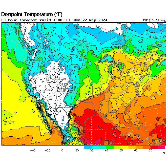
1. Dewpoint>55°F - Severe thunderstorms need a lot of moisture to condense into cumulonimbus clouds. Outline and lightly shade in green the area of the of the United States that has a dew point greater than 55°F.
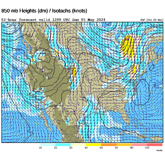
2. 850 mb Low Level Jet Max - Strong winds near the bottom part of the troposphere can quickly bring in moisture to feed severe thunderstorms. Outline and lightly shade in purple the area that has winds greater than 30 knots.
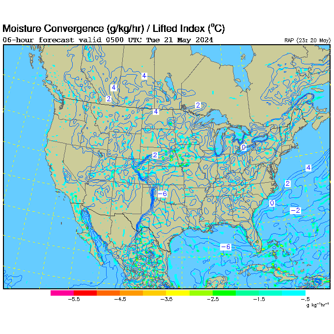
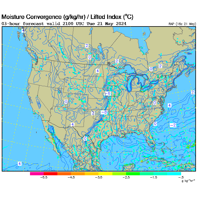
3. Lifted Index (LI)<-4 - Lifted Index is a measure of how fast air wants to rise up in the atmosphere. Numbers less than zero represent air that wants to rise faster. Outline and lightly shade in orange LI's below -4.
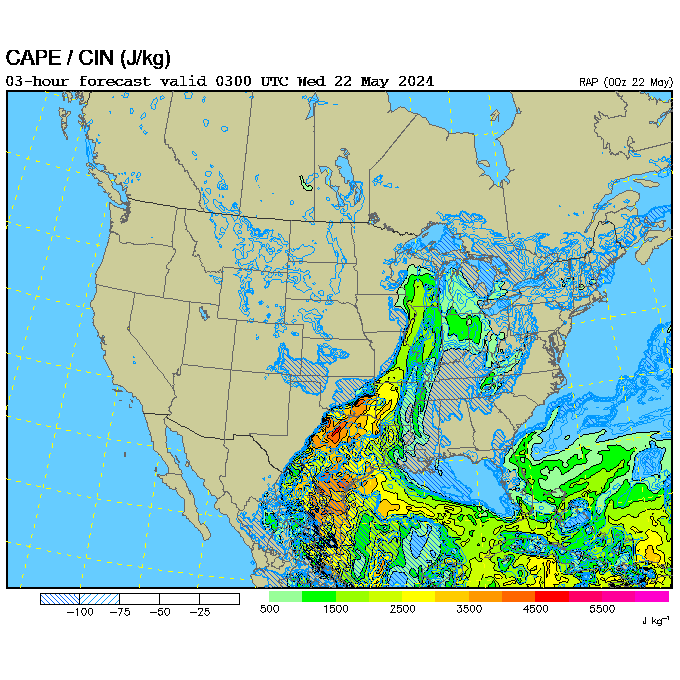
4. Convective Available Potential Energy (CAPE)>1,500 J/kg - High CAPE means that storms will build vertically quickly. Large CAPE values are needed for air to rise quickly. Outline and lightly shade in blue CAPE values greater than 1,500 J/kg.
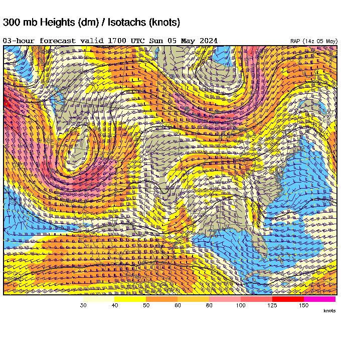
5. Jet Streaks >100 Knots - The jet stream is a river of air in the upper troposphere that travels at different speeds. Where the jet stream moves faster, meteorologist call it a "jet streak". Jet streaks can help produce severe thunderstorms by sucking air upward. Outline and lightly shade in red winds greater than 100 knots high in the troposphere.
6. Cold Front - Cold fronts are boundaries where cold, dense air lifts warm, moist air up in the troposphere. Severe thunderstorms often form just ahead of cold fronts. Draw in cold fronts on the map.
7. Create a Key in the bottom margin.
**Now it's time to predict which part of the United States has the greatest chance of seeing severe thunderstorms this afternoon. Anayze the shaded areas on your first map, then outline and shade in the "bullseye" on your second map in red where severe weather is most likely to occur. Label this area "Greatest Risk of Severe Weather".
| 